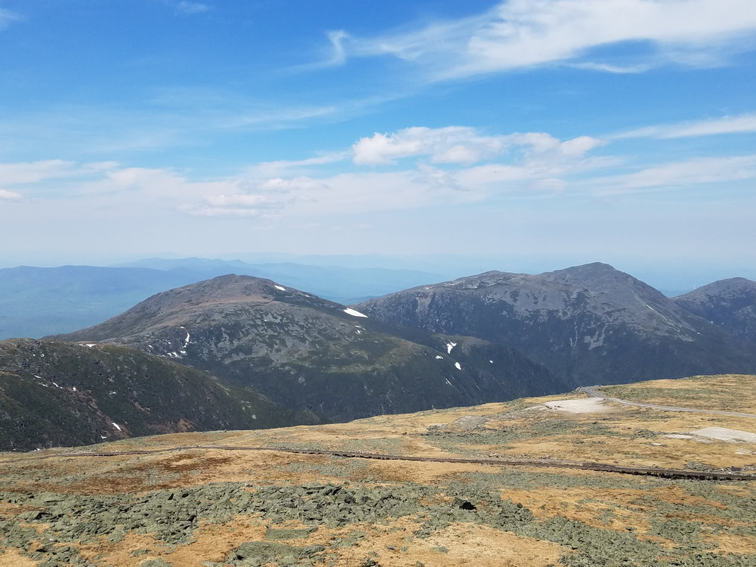
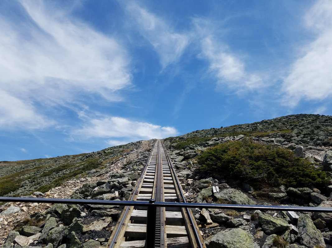
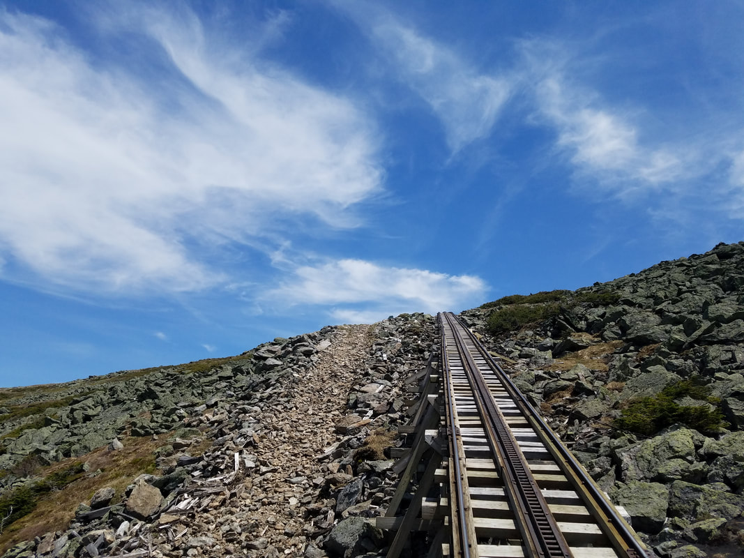
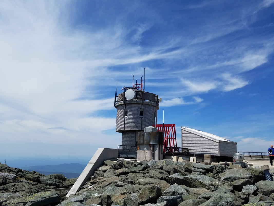
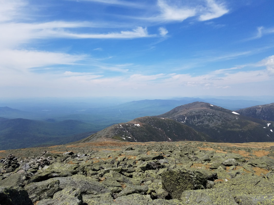
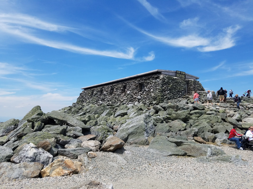
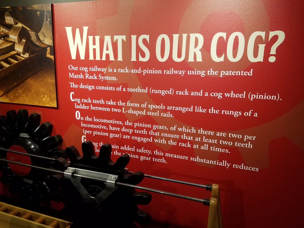
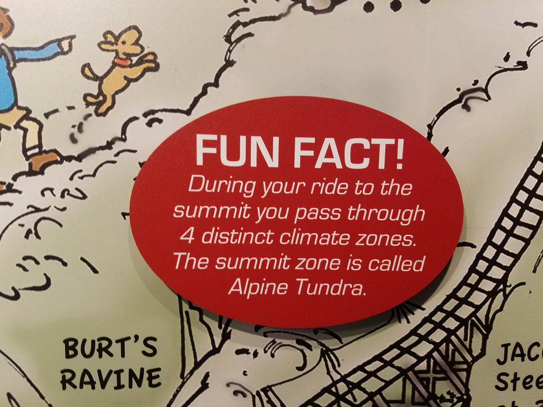
 Mount Jefferson is the one with the snow. That snow doesn't melt until July. Mount Jefferson is the one with the snow. That snow doesn't melt until July. Incredible. A must do. Ride, don't drive. If you ever get up to the New England states and you travel to New Hampshire, a visit to Mount Washington is something you do not want to miss. On a good day you will get to witness one of the most spectacular views anywhere in the country. Reaching 6288 feet into the New Hampshire sky, Mount Washington is the king of the White Mountains and is one of many peaks in the Presidential Range. If you look it up on Wikipedia, you'd see this... "The Presidential Range is notorious for having some of the worst weather on Earth, mainly because of the unpredictability of high wind speeds and whiteout conditions on the higher summits. Because of the poor weather conditions, the Presidential Range is often used for mountaineering training for those who go on to climb some of the world's highest mountains, including K2 and Everest." One thing they tell you right before you get off the train at the top is "don't miss the train going back down", You don't want to have to hike down this mountain. Even in the summertime, the top of Mt Washington is covered in fog 90% of the time. During the trip up and down the mountain on the cog railway you'll notice all of the stacks of stones known as cairnes (can be seen and talked about in the videos below). Those are used as trail guide markers for the hikers. Since you can hardly see in front of you in the fog, the markers are placed VERY close together to help keep you on the path and not fall off the mountain. As you approach the top of the mountain the Appalachian Trail crosses the tracks, and the hike across Mount Washington and the Presidential Range is considered to be the most difficult hike on the entire Appalachian Trail. 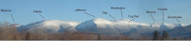 The Presidential Range of the White Mountains You have three ways to get to the top of Mount Washington, you can walk, you can drive, or you can take the cog railway, and that is the method we took. It's about a 4 hour hike to the top and then another 3-4 back down, so unless you are REAL adventurous and have perfect weather, that is probably out of the question. You can also take your own car to the top by driving on the Mount Washington Auto Road, but a word of caution. This road has no guardrails and if you mess up, there is nothing to stop you and your vehicle from tumbling to the bottom. I haven't been on it but I hear from others that have that it's terrifying. It's makes it hard to enjoy the views when you have to worry about driving off a cliff. See the video at the very end of this post, then decide. ;-) So... that leaves the cog railway. THIS is the way to go. This is from their website: The Mount Washington Cog Railway is a narrated 3-Hour-Round Trip train ride to the summit of Mount Washington on a historic and awe-inspiring railway. Averaging around 1 hour each way, you have 60 minutes to explore and take in the Summit of Mount Washington, including the Sherman Adams Visitor Center. Inside the Visitor Center is a museum, post office, small snack bar and 360° views of the surrounding areas including up to 5 states, Canada and the Atlantic Ocean! Here's a video of the train that took us to the top pulling into the station. They operate multiple trains up and down the mountain during the day and our engine is one of the bio-diesels that they run. The Cog Railway also has a couple of steam locomotives in case you want that old time feel to the ride. Notice that the engine pushes the passenger car up the mountain instead of pulling. The engine has a cog (it's like a gear) that engages slots in the center of the track and that is how you get pushed up the mountain. The steepest grade is about 38%, so it looks like you're headed off into space at times. If not for the cog, the train would never be able to make it up the mountain. The passenger car has two sections of seating. The left side of the car (facing forward) has three seats and across the aisle are two more seats. When you make your reservations (and you MUST or you probably won't get a seat and certainly not the best seat) you want to get the front seats on the left because the best views are on that side of the train. The day we went up was about as good as it ever gets on Mount Washington, so the windows were down on the train. Keep in mind, some of the worst and wildest weather in the U.S. occurs on Mount Washington. Most of the time the mountain is in the clouds with fog and mist. In the winter, that fog and mist become rime ice that covers everything up there. For nearly sixty-two years Mount Washington held the world record for the fastest wind gust ever recorded on the surface of the Earth: 231 miles per hour, recorded April 12, 1934 by Mount Washington Observatory staff. To learn more about the day that wind speed was recorded, click on this link. Another item to note, the tree line starts about 5000 feet. Out in the Rockies, that elevation is about 10,000 feet. The maximum temperature ever recorded on the summit is only 72 degrees and the high the day we rode up was about 60 degrees, so it was a relatively warm day on the top. The image below shows the conditions right before we started the ride up (we had a 12:30 pm train). It was an incredibly warm day at the bottom, we had seen temps in the low 80's driving to the mountain so we knew the top shouldn't too bad. Even the winds cooperated that day and stayed at speeds that wouldn't blow you off the mountain like they normally do. Notice that our visibility was about 80 miles... today it's 1/16 of a mile (see image below). Here's a link to the current data. 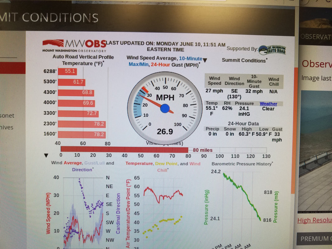 The image below is from today, June 14th about the time we left the station. Compared to our visit, it is much colder with no visibility today. Not a great day to go to the top if you want to see a view. 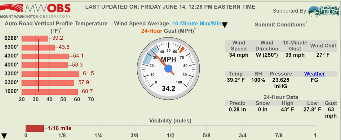 Conditions at 12:26 pm June 14. This is about the time we left. Compare this to how warm it was last Monday the 10th 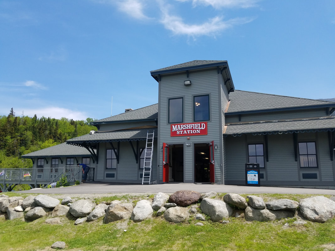 Mansfield Station Mansfield Station The elevation at the bottom where you start the ride up is about 1600 feet. It's funny, but Cadillac Mountain in Acadia National Park is 1529 feet high and you think that's tall when you're on top of it, so this being at the bottom helps put things in perspective. The station has a gift shop, a restaurant, and restrooms. If you didn't purchase your ticket online, you get your tickets here. There are no restrooms on the train so go before you board. It's very cool looking up toward the top of the mountain from the station. You can barely make out the tower on the top, and off in the distance you can see the train tracks going up the side of the mountain. Now... picture yourself hiking that. :-) 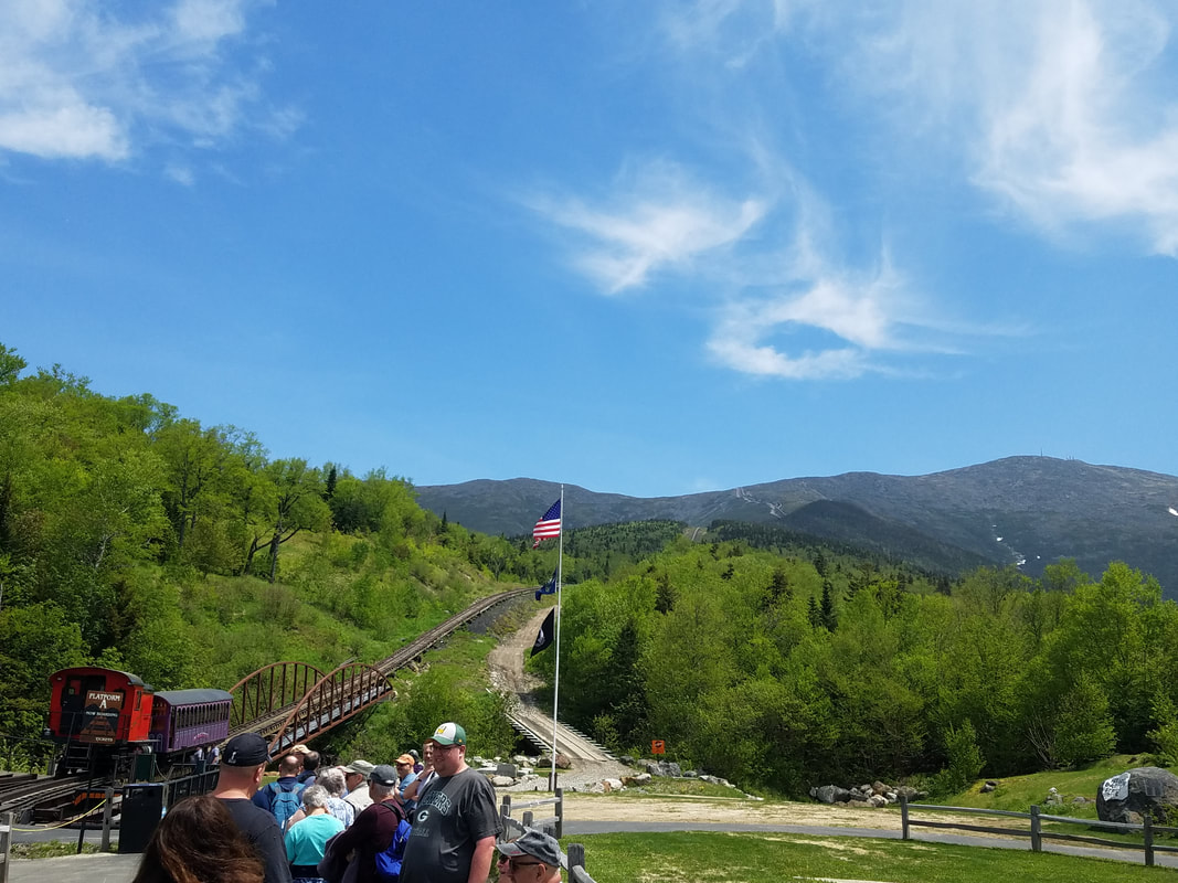 The top is on the top of the peak in the right of the image. You can see the tracks in the distance to the right of the flag. I mounted my GoPro on the window using a suction cup mount. Stupid me... I could have mounted the actual camera part of it in the open part of the window, but instead, the whole thing was behind the window. It doesn't seem to hurt the image to much but I'm sure it helped with reducing the wind noise. Granted, the train only moves about 4 MPH, so the wind noise doesn't come from the train movement. :-) Anyway... here are my videos from the front of the train. I should have mounted the camera on the left side window to catch the views, and I was going to on the way down, but someone on the other side of the aisle asked if they could swap seats with us for the return trip. And being the nice person that I am, we swapped, so I didn't have the best view coming back down. And trust me, the left side is spectacular. The pictures I have just don't do it justice. The conductor was great and full of information, I was glad I captured his narration on the videos. It is a ride you'll never forget. I've added a few pictures below, but if you'd like to see them all, you can click on this link. Keep in mind that during times of bad weather, the train may not go all the way to the top. They will ride halfway and when there is snow, they stop at a newly built platform and everyone can get off the train and hang out at a bonfire and eat s'mores. We were very blessed with our weather and it couldn't have been more perfect. Because the weather on the top is so unpredictable and generally not so good, it makes it very tough to factor in to your plans. You plan for the worst and hope for the best, and in our case, that's the way it worked out, so your visit may or may not go as well. That's Mount Washington. Once you're at the top there are several places to explore, and if you're hungry you can grab a bite to eat eat while you're there. And there is even a United State Post Office on the top so you can send mail with a Mount Washington postmark. The Mount Washington Observatory on top is continuously staffed even in the winter time. Research is conducted on new weather instruments and manually taken weather readings occur on schedule 24/7. Not much more to say except you need to add this place to your bucket list. I do recommend the train up, but if you think you may want to drive up, watch this video below. You will be amazed and terrified at the same time. :-)
0 Comments
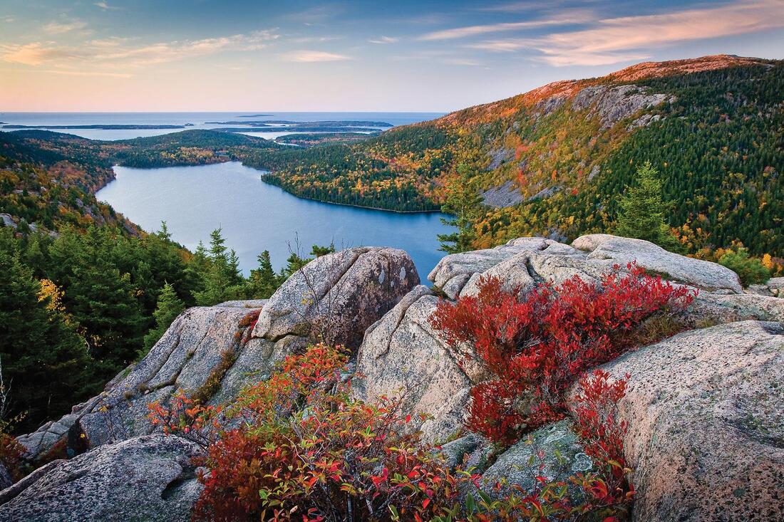 Jordan Pond, Acadia National Park Jordan Pond, Acadia National Park
This is going to be the story of our two week vacation through the New England states, complete with all of the places we will see, things we will learn, and memories that we will make. Amy and I will include as many pictures, videos, links to the places and things we do, as well as any other information we can find to help document the entire trip. (You know, just in case you'd like to go sometime :-)
When I was 16 years old my parents took us on a trip to the New England states and I still remember parts of that trip to this day. Since my wife Amy has never been to that part of the country (except for a trip to NYC), it will be a new experience for her and a great refresher for me, and there are a lot of places that we'll be going that I've never seen as well, so this ought to be fun! This is going to be a driving trip. We thought about flying up and getting a rental car up there, but there are so many great places to see along the way, it would be a shame to not take the scenic route by driving versus flying. The total round trip length is about 3000 miles, so it's going to be a long haul with many days in the car. And since I didn't want to put that kind of mileage on my own vehicles, we are renting a SUV (Ford Explorer supposedly) for the trip. We have most of the itinerary planned now, so I'll be posting maps and more details as we get closer in time. Basically, we pick up the rental vehicle at on Wednesday the 29th, start the trip on the morning of the 30th, and we return home on Wednesday, June the 12th. During the time we are gone, we will pass through a total of 15 states, 11 of which Amy has never seen. On the way up we will travel through Georgia, South Carolina, North Carolina, Virginia, Maryland, Delaware, Pennsylvania, New Jersey, New York, Connecticut, Rhode Island, and into Massachusetts. We will set up home in West Yarmouth (next to Hyannis, see map below) in Massachusetts for a stay at the Holly-Tree Inn condo. From there we'll spend almost an entire week exploring Cape Cod and the surrounding area before we embark on a two day drive up the coast to Bar Harbor Maine where we'll stay another two nights at the Coach Stop Inn Bed and Breakfast. We plan on getting off the beaten path and hug the coast as much as possible in order to see all the sights along the way. Our route will pass through a very small section of New Hampshire (Portsmouth) on our way into Maine, and we will be stopping at numerous places all along the coastline before staying at Kennebunk Friday night. The next morning (Saturday) we take the back roads that will lead use to Bar Harbor. Sunday morning after arriving in Bar Harbor, we have to get up REAL early so we can go capture the sunrise (the sunrise is 4:50 am!!!) from Cadillac Mountain in Acadia National Park. From there we will drive up to the US-Canadian border at Eastport Maine, maybe see the "Old Sow", the largest tidal whirlpool in the Western Hemisphere, and eat a lobster roll at Quoddy Bay Lobster before heading back to Bar Harbor. The return trip begins after breakfast on Monday the 10th, and the first day on the road will lead us across the beautiful forest and mountains of northern New Hampshire. We stop for a three hour round trip ride on the Cog Railway to the top of Mount Washington before continuing the trip south along the Vermont/New Hampshire border where we'll stop to sleep in Woodstock, Vermont. After an overnight rest, we get up early the next morning to begin a long day of driving toward the Cave Hill Farm Bed and Breakfast in Virginia. Rising with the sun on Wednesday the 12th, we'll drive on a section of the Blue Ridge Parkway through Virginia and North Carolina before hopping back on the interstate to finish the trip home. We have a lot of things planned while we're gone, like stopping at the Independence Hall in Philadelphia, taking the ferries to Nantucket and Martha's Vineyard islands for day trips, a 4 hour whale watching tour, a guided walking tour in Boston, a trip to the top of Mount Washington, and stops for what is supposed to be some of the best seafood (IE... lobster) and lighthouses anywhere. In between, there will be a thousand other things to see and do, and I hope we can capture it all so you can follow our fun. I'll break all of this out by making a new post for each day of the trip, so we should end up with a minimum of 14 different post. I'm sure I will also create a special post or three for those special side trips, highlights, and activities that we do. I'm also sure the post will be delayed since I can't spend all my time writing blog post :-) Who knows... I've never documented a two week trip before. I'm just winging it right now ;-) The Hardware
In order to capture all of the sights and sounds of the trip, I just "had" to buy more electronic gadgets and equipment. Of course :-) The camera I really wanted to buy I just couldn't get right now, a Sony A6400 camera with a couple of nice lenses. Of course I couldn't just stop with the camera, I would also need a good gimbal to go along with it. By the time you add all of that up, I'm in the $2500 range (IF I'm lucky), so all of this will have to wait until sometime after the trip. That won't leave me with a shortage of cameras though :-)
Samsung S7 Edge
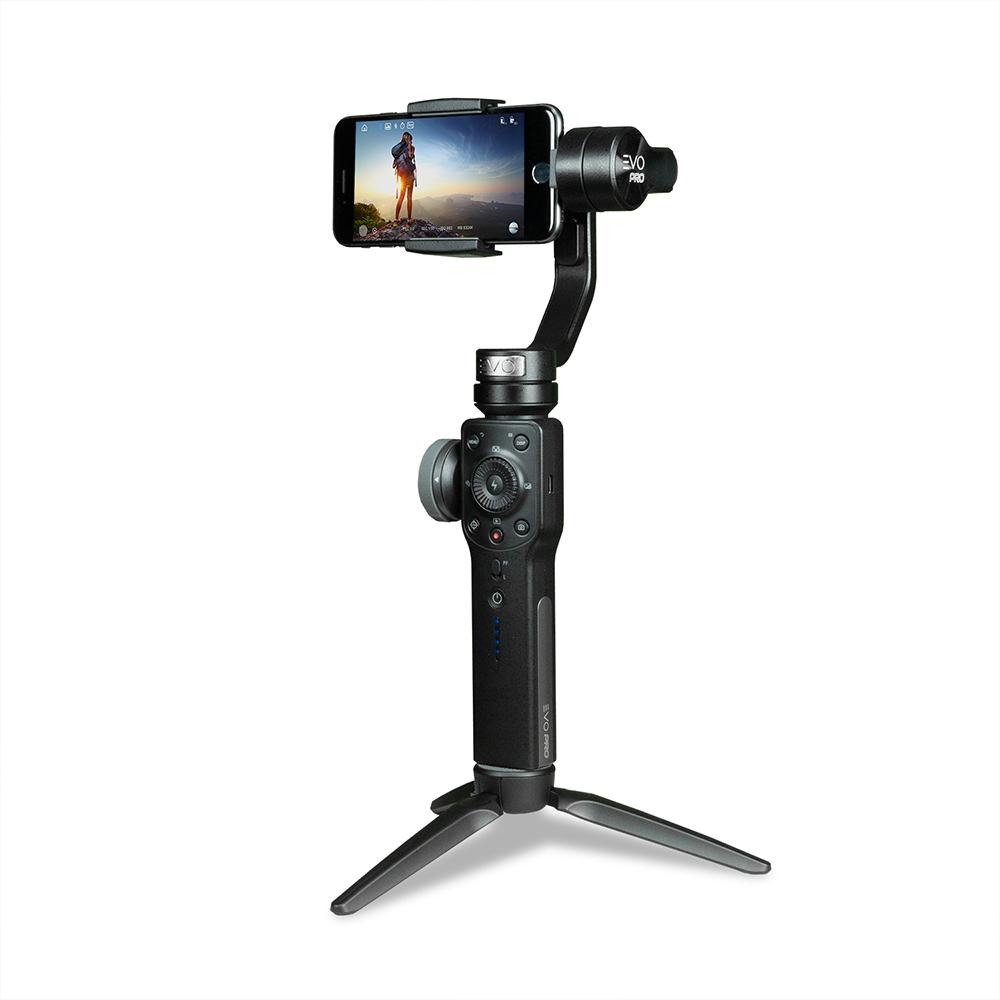
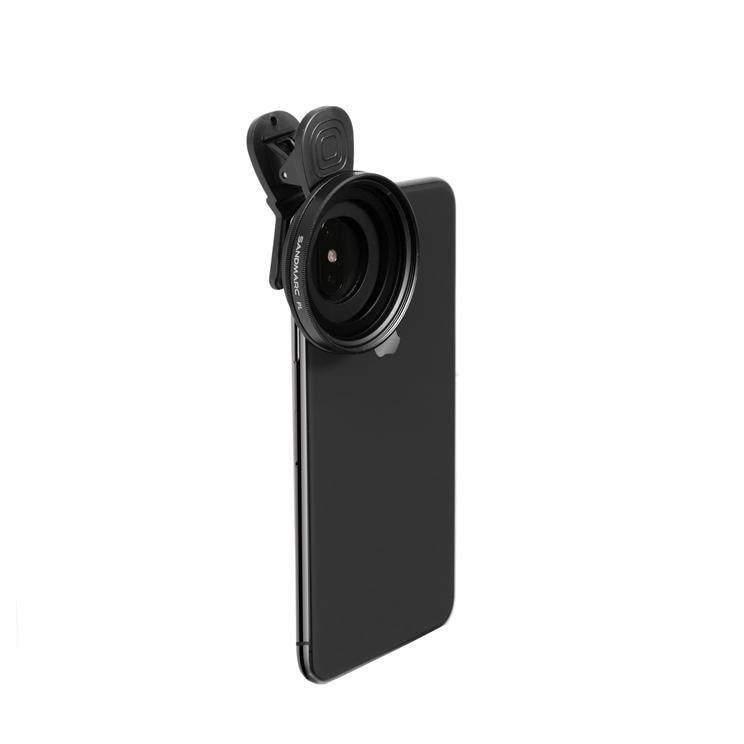
Even though this is my phone, this is one awesome camera. The picture quality is superb and it handles low light conditions with ease. While the camera can record 4K videos, I will have it set for 1080p resolution to help save space and make them easier to share. I plan of doing a few time lapse videos using the camera and hopefully one of those will be the sunrise on Cadillac Mountain in Acadia National Park. To make sure I get the best pictures and video possible from this camera, I purchased an EVO Pro Gimbal to help me keep things steady and a Sandmarc polarizing filter to help with the image quality/reflections in bright light conditions. The gimbal is the EVO version of the Zhiyun Smooth 4, and I have it paired with the FiLMiC PRO app (paid app) on my phone. I can control almost all of the cameras features from the handle on the gimbal, even things like exposure and focus, as well as start and stop videos and take pictures. The FiLMiC PRO app is a must have if you use your the camera in your phone for lots of photography and/or videos. I'm also using another paid app called Lapse It Pro. Lapse It Pro is a full featured time lapse application for your phone.
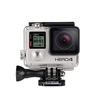
GoPro Hero4
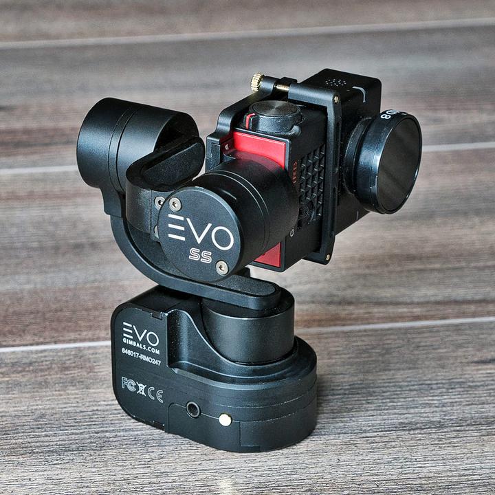
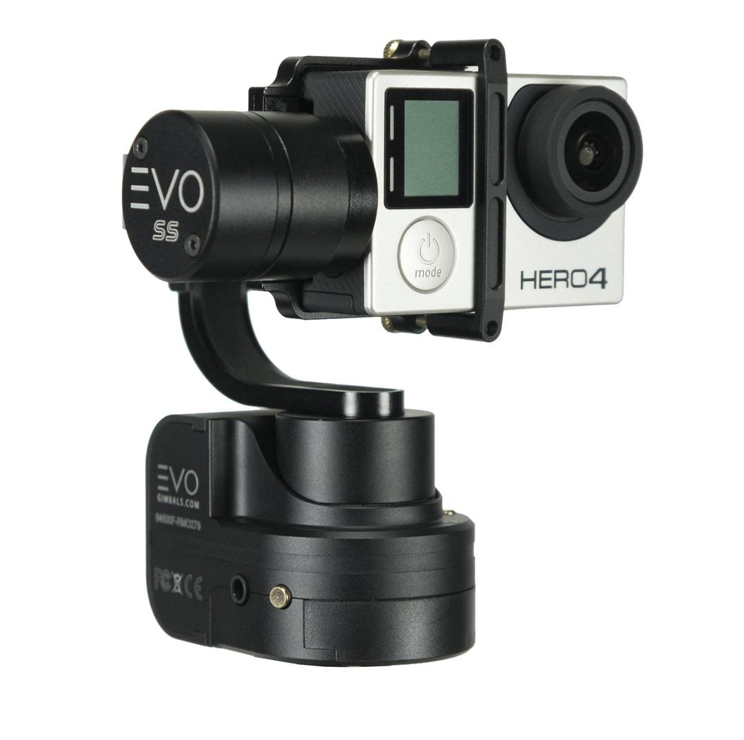
I've had this camera for a while, and it's still a great little camera. This has been my autocross camera for 3-4 years now. It too will take 4K videos but I will be using this in 1080p resolution. I really love the quality of this camera. I also like the fact that I can set it up to do time lapse videos, so it will be used for those as well. And like my S7, I also purchased an EVO SS 3 axis wearable gimbal that I can use with this camera as well as the new Akaso 4K camera that I purchased (see below). I might look stupid with it on, but I also have a Stuntman Chest mount that I can attach the gimbal to for hands free recording. If you'd like to see how smooth the gimbal is on a chest mount... take a look at the video below.

Akaso V50 Elite 4K Action Camera
I just got this camera for the trip. It was pretty inexpensive (cheaper than the GoPro) and packed with a lot of features, so I thought I'd see how it works compared to my GoPro. Preliminary thoughts are that the picture quality is not quite as good as the GoPro, which is a little disappointing. But I'll give it a chance and put it through its paces. Again, I will "probably" not be shooting 4K videos, but I might try to do one or two just to see how they turn out. 1080p is all that most people can stream, so I'm going to stick to that resolution for the most part. This camera and the GoPro can be mounted on the EVO gimbal, a head strap, chest strap, pole, suction mount, roll bar mount, or any mount that a GoPro can mount on. I will have a lot of flexibility in how I mount and use these, so I'm going to try to be creative. I'm really going to have to learn more about Adobe Premiere Pro to manipulate all my videos. 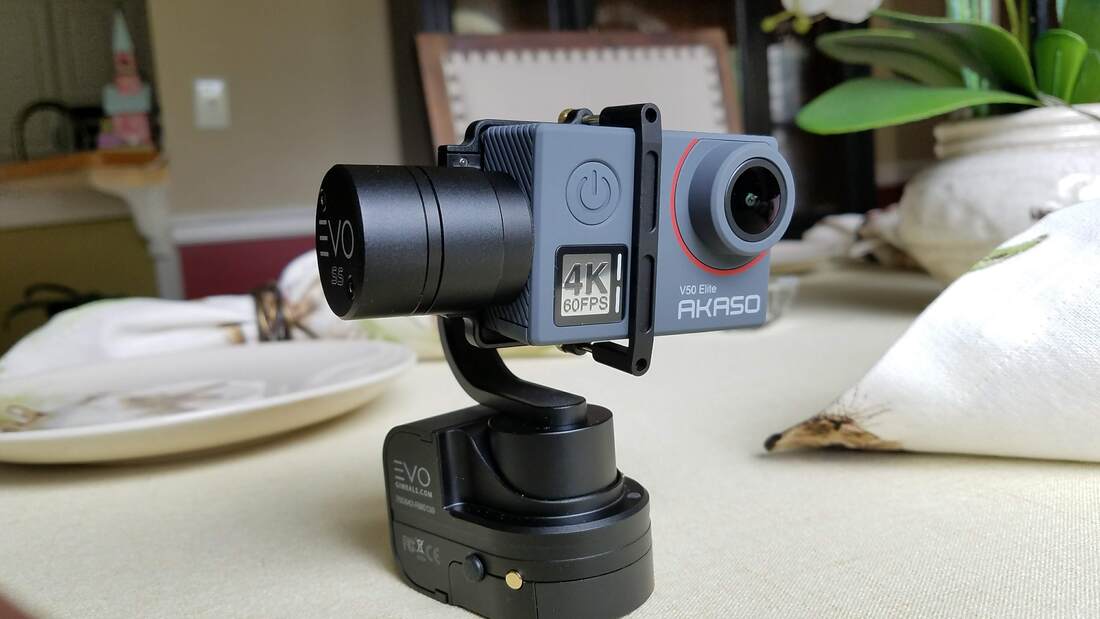
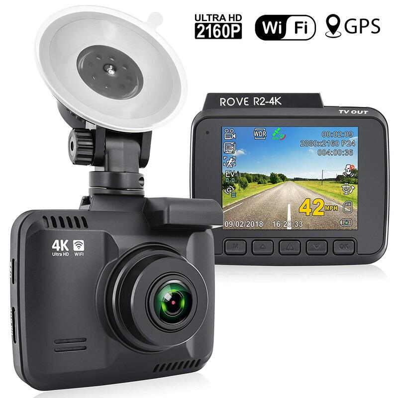
Rove R2-4K Dash Cam
One more. :-) This will be my dash cam for the trip. I haven't had it in the car yet, but played with it in the house and really like this. This tiny camera has a ton of features:
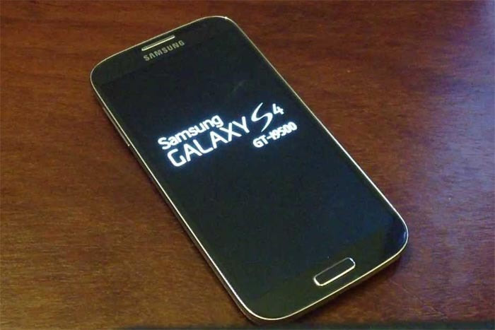
Samsung S4 (x2)
When you need a backup. We have two working S4 Galaxy phones that also shoot 1080p videos. We will use these as supplemental devices just in case. I also have a Samsung tablet that is used for various miscellaneous uses that will go with us. That's all I've got :-) I really hope we can get some great shots of the trip... if not it will entirely be my fault :-) 
I almost forgot a couple of items that I can't do without. I know I'm leaving out things like my tripod, power strips, various mounts, all kinds of cables, flashlights, kitchen sink, and all types of other assorted pieces that you would possibly ever need. Or not. Be prepared I say! :-)
Key Power Quick Charge 3.0 6-Port USB Wall Charger (x2) Because I have SO many devices that charge using an USB charger, I needed lots of charging ports. This is the latest charger that I've bought, and I bought two of them.

Qualcomm Quick Charge 3.0 5-Port USB Wall Charger
This is the first charger that I purchased a year or so ago. These are the only way to charge when traveling, especially if you have a lot of devices to charge, and I could really use one more like the one above. I believe I counted about 14 things that I own that need a USB charger. This one is a 60 watt/6.4 amp charger. With all three chargers, I have a total of 17 charging ports. I have a separate 2 port charger for our Fitbit's, and a separate charger for the storage battery (see below). 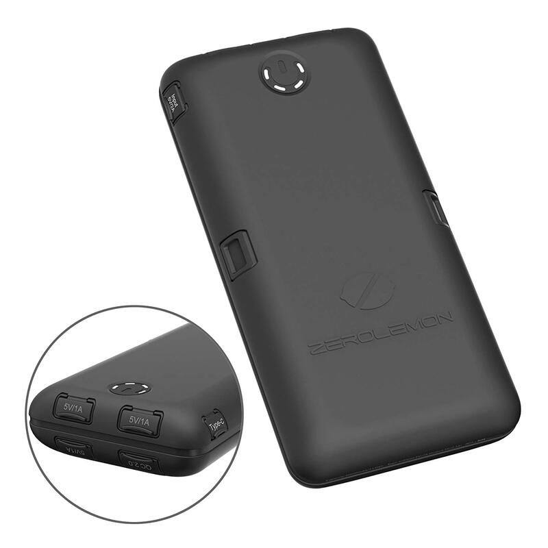
Ultra High Capacity ZeroLemon ToughJuice 30000mAh 7A Output Portable Charger
While it says charger, it is a giant battery that you can use to charge your devices. This is a "MUST have" if you do any extended picture taking or recording and you aren't going to be near a power source. If you found yourself in that situation, this would be one of those items you wouldn't want to be without.
|
OLD NORTH GA WX BLOG


 RSS Feed
|
Never base important decisions on this or any weather information obtained from the Internet. Always have a backup method of receiving weather information such as a battery powered weather radio.
Copyright © 2018 NorthGeorgiaWX.com and DaculaWeather.com 
|