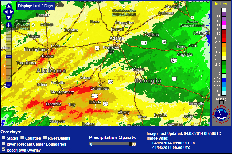
 Well, I hope everyone enjoyed the rain yesterday. OK... so Sunday was dry, the weatherman got it wrong. But they sure got it right yesterday with many areas still under Flash Flood Warnings. As of this morning, there was still one gauge in Moderate flooding, 23 in Minor, and 53 near flood stage across the southeast. Close to us, Suwanee Creek, Big Creek near Alpharetta, and the Middle Oconee River near Arcade are still in Flood Stage. I ended up with a total of 3.08" from this system. My 7 year average for April is 3.80", so I got pretty close to my monthly total in about 24 hours. Some areas in Alabama got crushed by heavy rain with some areas receiving 6-8". If you compare the actual rainfall map to the left, to the predicted map to the bottom, you can see the forecasted placement was spot on. 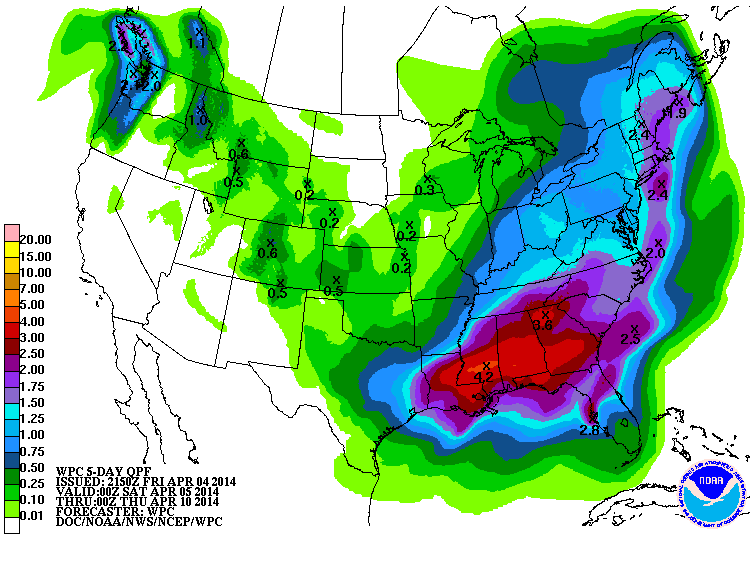
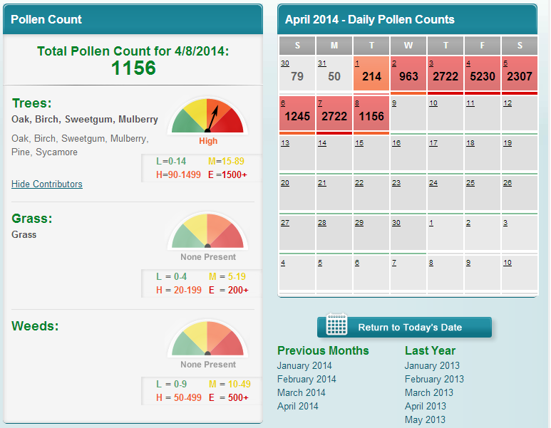 Brought to you by the Atlanta Allergy and Asthma Clinic Brought to you by the Atlanta Allergy and Asthma Clinic The pollen count today is 1156... Brought to you by the Atlanta Allergy and Asthma Clinic It's looking nice from Thursday through the weekend, and starting Thursday, temps will rebound back into the 70's and remain that way all the way through Sunday.
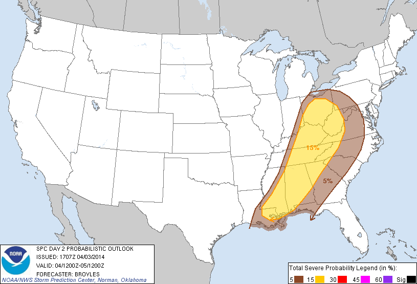
Enjoy the weather... 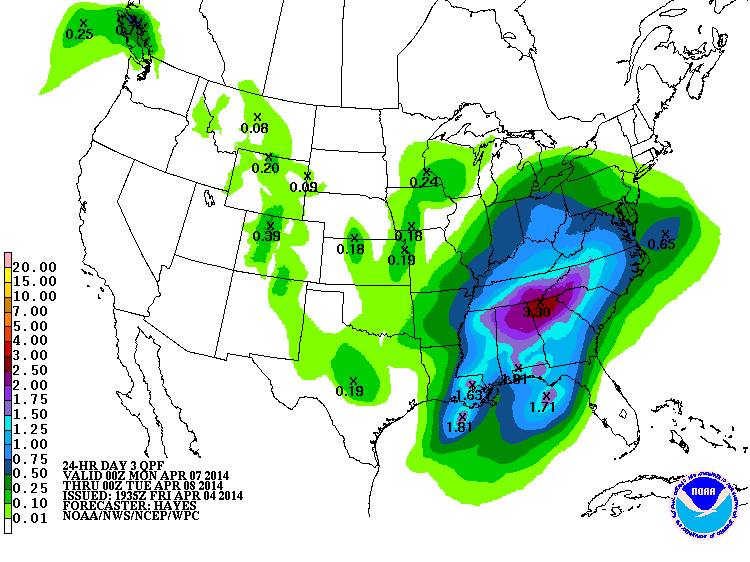 Click for full size image (Mon-Tue precip) Click for full size image (Mon-Tue precip) Today was most certainly a dud, but again, it was anticipated that the upper air dynamics would be moving off to the northeast and taking the rain along with it. But the next system in line is going to be a very different story. A very substantial rainfall is in the cards for the southeast as you can see from these couple of images. Rain will begin on Sunday but Monday will most likely have the heaviest rainfall. The Atlanta NWS says 2-3" may fall and the Storm Prediction Center had this to say this morning in the 4-8 day outlook discussion:
The Atlanta National Weather Service office said this about it in their afternoon discussion. There is still a chance for severe weather as you can see from the discussion below. .LONG TERM /SUNDAY THROUGH FRIDAY/... So keep the umbrella handy beginning Sunday, and then maybe a rainsuit for Monday. :-)
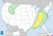 Some very rough weather over Missouri today, with some very large hail as well as several tornadoes. This area continues to push east and will be arriving here tomorrow, but in a much weaker state. The Storm Prediction Center has placed us in a Slight Risk area for tomorrow, and I believe that for us, that will be later in the afternoon. In their 12 noon Day 2 Outlook Discussion, they outline how they believe this will play out over the southeast as the day goes on tomorrow. Our biggest threat will be strom damaging winds, but a tornado can't be ruled out.
|
Archives
March 2019
Categories
All
|
OLD NORTH GA WX BLOG

 RSS Feed
|
Never base important decisions on this or any weather information obtained from the Internet. Always have a backup method of receiving weather information such as a battery powered weather radio.
Copyright © 2018 NorthGeorgiaWX.com and DaculaWeather.com 
|